BREAKING: USPS slashes address verification to 60 addresses/hour. What now?
Rooftop geocoding - A crucial insurance risk analytics tool
Products used
US Address Verification
US Rooftop Geocoding

The client
Risk is the nemesis for property insurance companies; finding ways to minimize risk is key to an insurer’s success. Utilizing the hyper-accurate technologies of Smarty, a leading risk analytics client verifies the validity of street addresses, provides the corresponding rooftop geocodes and then confidently relays property intelligence data crucial to its insurance customers.

The challenge: Accurate rooftop geocoding in high-risk areas
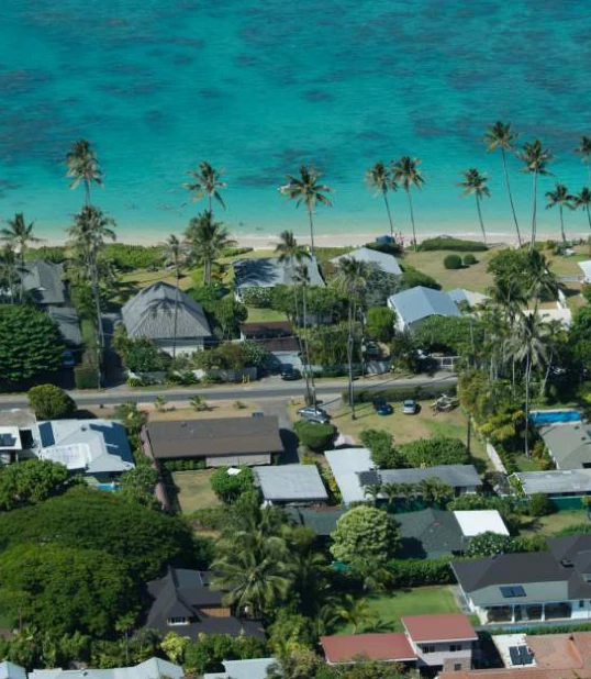
Identifying and analyzing high-risk areas with exactness is one example of how the client serves its property insurance customers. How close is the primary structure to vegetation, to a floodplain, or to a coastline, and what types of buildings are on the property? In-person inspections can find answers to these questions, but at significant expense of time and money. The client sought to provide detailed insurance property risk analysis without sending a person to the site.
The solution: Smarty address validation and geocoding APIs
The client first considered Smarty for address standardization and found the technology to be a fast, accurate solution. “Latency needs to be really small, and Smarty delivers on that, as well as on its ability to manage our throughput without any issues,” said the client’s lead scientist.
After developing trust in Smarty by successfully using the address verification services, the client was quick to adopt rooftop geocoding when Smarty began offering the service in 2020.
“I did extensive testing to compare Smarty geocoding to that of a different leading vendor we used previously,” said the lead scientist. “I found Smarty to be faster, more accurate, and even more honest about their results. That’s very valuable for us because we can pass that information on to our customers.“
I found Smarty to be faster, more accurate, and even more honest about their results
The results: Confident insurance geocoding results
The accurate rooftop geocoding delivered by Smarty allows the client to pinpoint property insurance risk with exactness. For example, in a fire risk analysis, rooftop geocoding helps the client pinpoint a structure's proximity to vegetation that puts an insured customer at high fire risk, so the client can tell its insurance customer, “This property is high risk because it has that tree next to the building."
"Geocoding accuracy is key for us: a key part of our workflow and the basis of what we do,” said the lead scientist. “If we get that wrong, everything else we do is useless.” Because Smarty validates addresses and provides rooftop geocodes with such speed and accuracy, the client has a high level of confidence in each analysis it sends its insurance customers.
More success stories
See how organizations around the world are benefiting from our services

Rooftop geocodes for weather risk modeling
Predicting future risk for pre-construction homes requires precise location data.

Insurance company chose to modernize their technology
Insurer saved 100+ hours with cloud address verification

How Lake County improved voter systems
Better address data aids bill and ballot deliverability